Packhorse Bridge
Introduction
The photograph on this page of Packhorse Bridge by Richard Croft as part of the Geograph project.
The Geograph project started in 2005 with the aim of publishing, organising and preserving representative images for every square kilometre of Great Britain, Ireland and the Isle of Man.

There are currently over 7.5m images from over 14,400 individuals and you can help contribute to the project by visiting https://www.geograph.org.uk
Packhorse Bridge
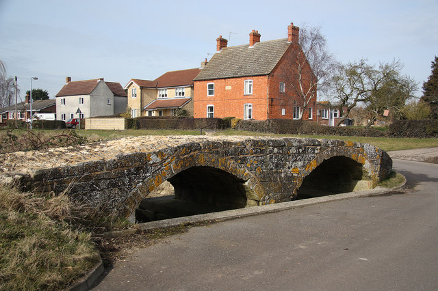
Image: © Richard Croft Taken: 5 Mar 2010
Packhorse bridge at Northbeck, known locally as Roman Bridge, probably due to its proximity to Mareham Lane. Sometimes said to date from 1250, but most likely built in the 17th century and not technically a packhorse bridge as it's about 3m wide. The ford through North Beck has been replaced by a road and the bridge restored by Lincolnshire County Council in 2004.
Images are licensed for reuse under creativecommons.org/licenses/by-sa/2.0
Image Location
Latitude
52.954815
Longitude
-0.368965