Cowley Bridge
Introduction
The photograph on this page of Cowley Bridge by Derek Harper as part of the Geograph project.
The Geograph project started in 2005 with the aim of publishing, organising and preserving representative images for every square kilometre of Great Britain, Ireland and the Isle of Man.

There are currently over 7.5m images from over 14,400 individuals and you can help contribute to the project by visiting https://www.geograph.org.uk
Cowley Bridge
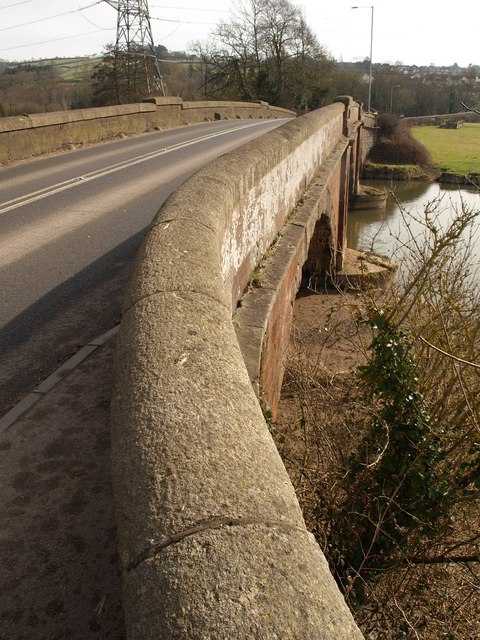
Image: © Derek Harper Taken: 2 Mar 2010
There are two Cowley Bridges, across the Creedy and the Exe, and the maps indicate that this is the River Creedy, although descriptions of the bridge refer to the Exe. The bridge was built "to replace a 12-arched bridge" in 1813-14 by James Green, the Devon County Engineer and Surveyor http://www.imagesofengland.org.uk/details/default.aspx?id=86110 . Nicely rounded coping to the parapet.
Images are licensed for reuse under creativecommons.org/licenses/by-sa/2.0
Image Location
Latitude
50.74896
Longitude
-3.550667