Lugg's Farm
Introduction
The photograph on this page of Lugg's Farm by Derek Harper as part of the Geograph project.
The Geograph project started in 2005 with the aim of publishing, organising and preserving representative images for every square kilometre of Great Britain, Ireland and the Isle of Man.

There are currently over 7.5m images from over 14,400 individuals and you can help contribute to the project by visiting https://www.geograph.org.uk
Lugg's Farm
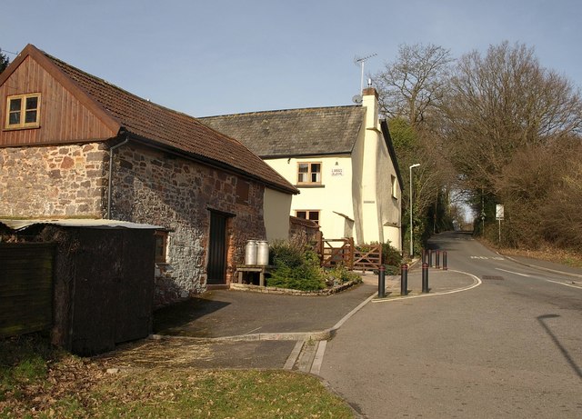
Image: © Derek Harper Taken: 2 Mar 2010
The C18/C19 farm, also shown in Image, finds itself now on a roundabout at the fringe of housing estates. The road on the right, climbing into Nadderwater, is shown on maps as Redhills, but the listed building description http://www.imagesofengland.org.uk/Details/Default.aspx?id=418389&mode=adv gives "Old Okehampton Road" as the address, so much traffic must have passed this way before the modern line of the A30 was developed through Wheatley.
Images are licensed for reuse under creativecommons.org/licenses/by-sa/2.0
Image Location
Latitude
50.725577
Longitude
-3.564205