Epping Forest: Wake Arms Triangulation Pillar
Introduction
The photograph on this page of Epping Forest: Wake Arms Triangulation Pillar by Nigel Cox as part of the Geograph project.
The Geograph project started in 2005 with the aim of publishing, organising and preserving representative images for every square kilometre of Great Britain, Ireland and the Isle of Man.

There are currently over 7.5m images from over 14,400 individuals and you can help contribute to the project by visiting https://www.geograph.org.uk
Epping Forest: Wake Arms Triangulation Pillar
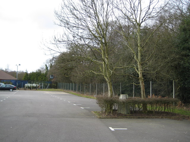
Image: © Nigel Cox Taken: 3 Mar 2010
Now incongruously situated in a reserve between two sets of parking bays for a restaurant, overshadowed by two thoughtlessly planted trees and entirely surrounded by a little hedge, the Wake Arms triangulation pillar may never be used by a surveyor again. In fact the Ordnance Survey website describes it as a subject of suspected vandalism. Since old maps show that the wood on the right pre-dated the pillar it was probably used with an observation tower anyway. The pillar has however outlived by some margin the public house after which it was named, which was demolished many years ago. The flush bracket on the side has a height of 112.02 metres or 367.5 feet above sea level.
Images are licensed for reuse under creativecommons.org/licenses/by-sa/2.0
Image Location


Leaflet Map data © OpenStreetMap
Latitude
51.67632
Longitude
0.062869