Golders Green: Northern Line railway viaduct
Introduction
The photograph on this page of Golders Green: Northern Line railway viaduct by Nigel Cox as part of the Geograph project.
The Geograph project started in 2005 with the aim of publishing, organising and preserving representative images for every square kilometre of Great Britain, Ireland and the Isle of Man.

There are currently over 7.5m images from over 14,400 individuals and you can help contribute to the project by visiting https://www.geograph.org.uk
Golders Green: Northern Line railway viaduct
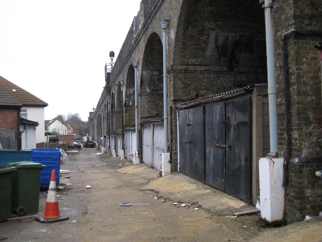
Image: © Nigel Cox Taken: 14 Feb 2010
The extension of the underground railway to Edgware in the 1920s involved the construction of a major viaduct to take the tracks over the valley of the River Brent. The viaduct starts here in Elmcroft Crescent and, apart from the embanked section around Image runs for about 700 metres to Shirehall Lane and Martin's Image It is evident from old Ordnance Survey maps that the railway cut a swathe through the existing housing estates, and that then fairly new residences in Elmscroft Crescent, Montpelier Rise and Woodstock Avenue must have been demolished to make way for it.
Images are licensed for reuse under creativecommons.org/licenses/by-sa/2.0
Image Location
Latitude
51.575323
Longitude
-0.210427