Whiting Bay
Introduction
The photograph on this page of Whiting Bay by Alan Walker as part of the Geograph project.
The Geograph project started in 2005 with the aim of publishing, organising and preserving representative images for every square kilometre of Great Britain, Ireland and the Isle of Man.

There are currently over 7.5m images from over 14,400 individuals and you can help contribute to the project by visiting https://www.geograph.org.uk
Whiting Bay
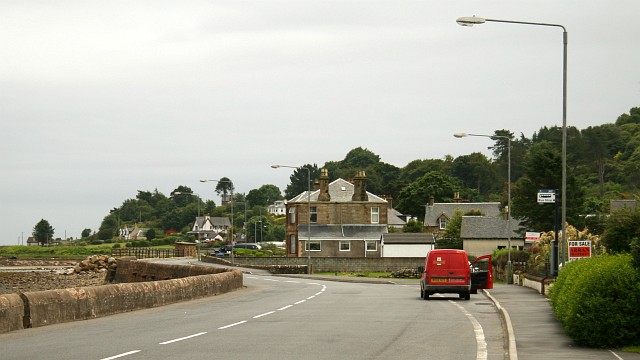
Image: © Alan Walker Taken: 27 Jun 2008
This photograph of the A481 through the southern end of Whiting Bay was taken from near its junction with the road from South Kiscadale. A few metres behind the viewpoint Image joins the A481. On the left of the photograph it is just possible to see the Glenashdale Burn crossing the seashore. To see a photograph (1968) taken from near the burn and looking back toward thus viewpoint, click here: http://www.geograph.org.uk/photo/1737103 .
Images are licensed for reuse under creativecommons.org/licenses/by-sa/2.0
Image Location
Latitude
55.484159
Longitude
-5.093337