Mardol, looking south
Introduction
The photograph on this page of Mardol, looking south by Natasha Ceridwen de Chroustchoff as part of the Geograph project.
The Geograph project started in 2005 with the aim of publishing, organising and preserving representative images for every square kilometre of Great Britain, Ireland and the Isle of Man.

There are currently over 7.5m images from over 14,400 individuals and you can help contribute to the project by visiting https://www.geograph.org.uk
Mardol, looking south
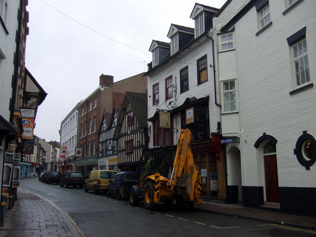
Image: © Natasha Ceridwen de Chroustchoff Taken: 3 Feb 2010
On the right in the image is The Shrewsbury Hotel and next to it the entrance to Carnarvon Lane, one of the town's 'shuts' or passages. The name, which has remained unchanged, was possibly connected with Welsh traders (the Welsh Bridge is close by although no longer directly at the foot of Mardol); more likely it was called after a C15 resident named Ludovick Carnarvon. Mardol was formerly spelt Mardefole or Mardeval, possibly meaning Devil's Boundary - whether this had to do with the rascally Welsh or with the area's mediaeval sex workers is anybody's guess.
Images are licensed for reuse under creativecommons.org/licenses/by-sa/2.0
Image Location
Latitude
52.709095
Longitude
-2.756891