Moorland, Oakdale
Introduction
The photograph on this page of Moorland, Oakdale by Jaggery as part of the Geograph project.
The Geograph project started in 2005 with the aim of publishing, organising and preserving representative images for every square kilometre of Great Britain, Ireland and the Isle of Man.

There are currently over 7.5m images from over 14,400 individuals and you can help contribute to the project by visiting https://www.geograph.org.uk
Moorland, Oakdale
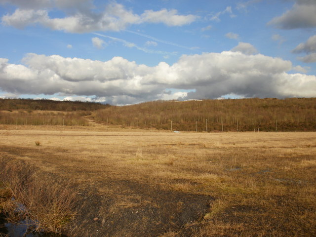
Image: © Jaggery Taken: 1 Mar 2010
An expanse of mostly flat moorland, elevation c 210 metres (nearly 700 feet), in a mostly hilly area near to Oakdale. In the lower left corner is a glimpse of a moorland stream which is about to descend 18 metres (about 60 feet) down a stepped waterfall. http://www.geograph.org.uk/photo/1734021 UPDATE August 2015. M J Roscoe states that this flat land is landscaped colliery waste, Waterloo. Currently (August 2015) the site is being prepared for the construction of a new school. The stream is also man-made.
Images are licensed for reuse under creativecommons.org/licenses/by-sa/2.0
Image Location
Latitude
51.684751
Longitude
-3.177399