Edgbaston Tunnel, Birmingham
Introduction
The photograph on this page of Edgbaston Tunnel, Birmingham by Roger D Kidd as part of the Geograph project.
The Geograph project started in 2005 with the aim of publishing, organising and preserving representative images for every square kilometre of Great Britain, Ireland and the Isle of Man.

There are currently over 7.5m images from over 14,400 individuals and you can help contribute to the project by visiting https://www.geograph.org.uk
Edgbaston Tunnel, Birmingham
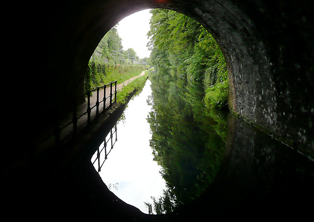
Image: © Roger D Kidd Taken: 8 Sep 2008
This is approaching the eastern portal of the tunnel, which is 105 yards in length (96 metres). This is the only one of five tunnels on the summit level of the canal to be provided with a towpath. The northern parts of the Worcester and Birmingham Canal were built in the early and mid 1790s, but finishing the thirty mile route to the River Severn at Worcester took twenty-three years. Industrial goods and coal were carried down to Worcester, and often on to Bristol. Grain, timber and agricultural produce were carried back to the growing towns in the Midlands.
Images are licensed for reuse under creativecommons.org/licenses/by-sa/2.0
Image Location
Latitude
52.465615
Longitude
-1.921002