
View of the Bovey Basin from Whitehill Road (2/3)
Introduction
The photograph on this page of View of the Bovey Basin from Whitehill Road (2/3) by Robin Stott as part of the Geograph project.
The Geograph project started in 2005 with the aim of publishing, organising and preserving representative images for every square kilometre of Great Britain, Ireland and the Isle of Man.

There are currently over 7.5m images from over 14,400 individuals and you can help contribute to the project by visiting https://www.geograph.org.uk
View of the Bovey Basin from Whitehill Road (2/3)
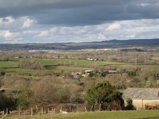
Image: © Robin Stott Taken: 19 Feb 2010
Looking just east of north over Higher Loady Park from below the cottages Image Noticeable on the left is the top of the tower of Teigngrace church in Image The pale ground above it is the clay waste mound being formed on the Rixey Park (provisional name) quarry site, mostly in Image The huge Southacre Quarry disappears below it and behind the yellow-green land, which is a grassed mound of clay waste northwest of Preston. The River Teign runs left to right at its foot. The bright strip above it is clay waste at the back of the aptly-named White Pit Quarry. Also visible are the blue-green clay sheds strung along the B3193. These features alone fill Image Nearer the camera, centre, are the houses at Mount Pleasant Image, another good vantage point for trying to understand this disrupted landscape. At close quarters much of it is hidden by trees and bunds.
Images are licensed for reuse under creativecommons.org/licenses/by-sa/2.0
Image Location

Latitude
50.537312
Longitude
-3.625564