
The top of Mile End Road, Highweek
Introduction
The photograph on this page of The top of Mile End Road, Highweek by Robin Stott as part of the Geograph project.
The Geograph project started in 2005 with the aim of publishing, organising and preserving representative images for every square kilometre of Great Britain, Ireland and the Isle of Man.

There are currently over 7.5m images from over 14,400 individuals and you can help contribute to the project by visiting https://www.geograph.org.uk
The top of Mile End Road, Highweek
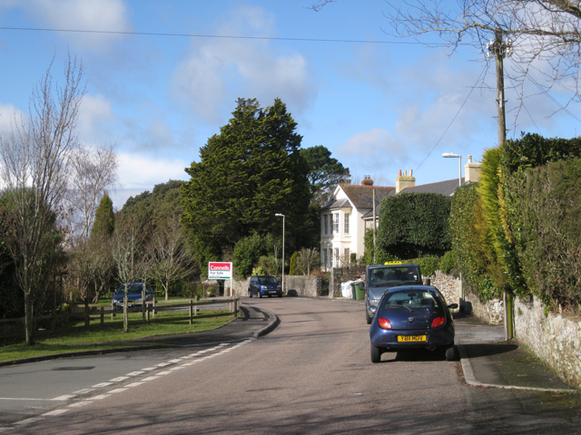
Image: © Robin Stott Taken: 19 Feb 2010
Highweek is one of Newton Abbot's hilltop Victorian suburbs, along with Knowles Hill and Wolborough Hill. In the days before there were proper sewer systems, such locations were favoured by the well-off middle classes because they enjoyed natural drainage downhill and were well away from polluted watercourses and foul air in the valleys. The mature evergreen trees are one of the signatures of the period - these are in the grounds of Daracombe.
Images are licensed for reuse under creativecommons.org/licenses/by-sa/2.0
Image Location

Latitude
50.537214
Longitude
-3.632616