Tairgwaith Trotting Track
Introduction
The photograph on this page of Tairgwaith Trotting Track by Anonymous as part of the Geograph project.
The Geograph project started in 2005 with the aim of publishing, organising and preserving representative images for every square kilometre of Great Britain, Ireland and the Isle of Man.

There are currently over 7.5m images from over 14,400 individuals and you can help contribute to the project by visiting https://www.geograph.org.uk
Tairgwaith Trotting Track
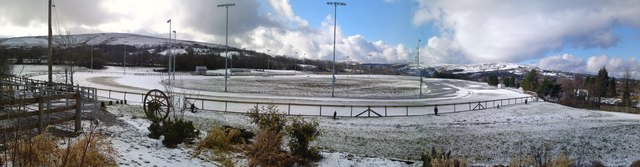
Image: © Anonymous Taken: 21 Feb 2010
Wintry panorama of Tairgwaith trotting track, built on land reclaimed from the Maerdy & Steer deep mine's spoil heaps.
Images are licensed for reuse under creativecommons.org/licenses/by-sa/2.0
Image Location
Latitude
51.791105
Longitude
-3.865564