Ballyboyland signal cabin near Ballymoney
Introduction
The photograph on this page of Ballyboyland signal cabin near Ballymoney by Albert Bridge as part of the Geograph project.
The Geograph project started in 2005 with the aim of publishing, organising and preserving representative images for every square kilometre of Great Britain, Ireland and the Isle of Man.

There are currently over 7.5m images from over 14,400 individuals and you can help contribute to the project by visiting https://www.geograph.org.uk
Ballyboyland signal cabin near Ballymoney
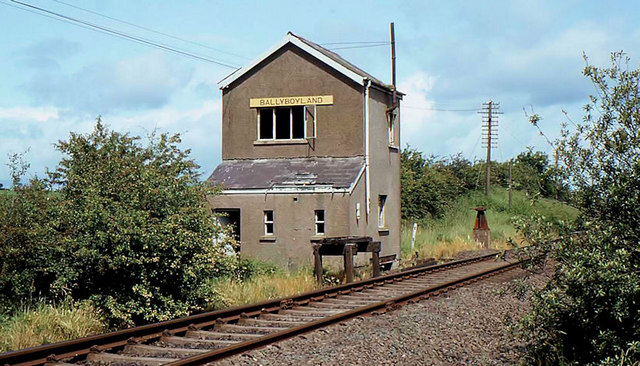
Image: © Albert Bridge Taken: 2 Jul 1983
The UTA built the cabin and passing loop in 1958 to divide the steep section between Killagan and Ballymoney. It closed in 1969 and was subsequently demolished. The brown object on its right is the remains of the tablet catcher.
Images are licensed for reuse under creativecommons.org/licenses/by-sa/2.0
Image Location
Latitude
55.077877
Longitude
-6.4609