Abutment of dismantled railway bridge
Introduction
The photograph on this page of Abutment of dismantled railway bridge by Rose and Trev Clough as part of the Geograph project.
The Geograph project started in 2005 with the aim of publishing, organising and preserving representative images for every square kilometre of Great Britain, Ireland and the Isle of Man.

There are currently over 7.5m images from over 14,400 individuals and you can help contribute to the project by visiting https://www.geograph.org.uk
Abutment of dismantled railway bridge
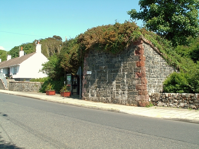
Image: © Rose and Trev Clough Taken: 6 Jun 2008
The bridge across Main Street carried a branch line from Portpatrick station down a steep hill to the harbour. The line had a very short life - open for only 3 months in 1868 http://www.railbrit.co.uk/Portpatrick_Railway/frame.htm . Portpatrick had been an important departure point for Ireland, but the harbour was unsuitable for larger ships, and it lost out to Stranraer. The line from Portpatrick town station to Stranraer and beyond continued in use until 1950.
Images are licensed for reuse under creativecommons.org/licenses/by-sa/2.0
Image Location
Latitude
54.843664
Longitude
-5.114988