The View from Bushey Hill
Introduction
The photograph on this page of The View from Bushey Hill by Glyn Baker as part of the Geograph project.
The Geograph project started in 2005 with the aim of publishing, organising and preserving representative images for every square kilometre of Great Britain, Ireland and the Isle of Man.

There are currently over 7.5m images from over 14,400 individuals and you can help contribute to the project by visiting https://www.geograph.org.uk
The View from Bushey Hill
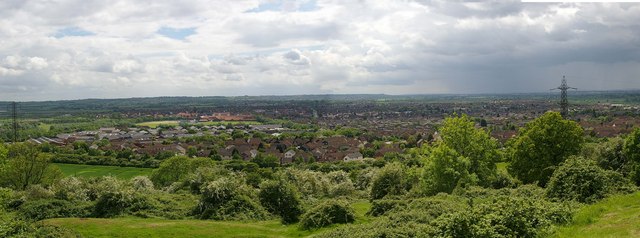
Image: © Glyn Baker Taken: 21 May 2006
The foreground of this picture is Bushey Hill which rises to 63m above sea level. The panorama looks over the flood plain of the River Crouch. Showing South Woodham Ferrers in all its glory. Our ancestors were wise to avoid building in flood plains the clue is in the name! It takes constant management of flood defences to keep towns like this one dry. If global warming causes rises in sea level some hard choices may have to be made.
Images are licensed for reuse under creativecommons.org/licenses/by-sa/2.0
Image Location
Latitude
51.655772
Longitude
0.619736