Bastion, Outer Walls, Pevensey Castle
Introduction
The photograph on this page of Bastion, Outer Walls, Pevensey Castle by Simon Carey as part of the Geograph project.
The Geograph project started in 2005 with the aim of publishing, organising and preserving representative images for every square kilometre of Great Britain, Ireland and the Isle of Man.

There are currently over 7.5m images from over 14,400 individuals and you can help contribute to the project by visiting https://www.geograph.org.uk
Bastion, Outer Walls, Pevensey Castle
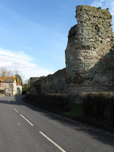
Image: © Simon Carey Taken: 20 Feb 2010
Parts of the outer walls date from the 4th century and were built up and strengthened during the medieval period. This bastion was added in the early Tudor period and has modifications from World War Two where the former gaps were filled in and a machine gun post, which is just visible, was added to cover the levels. The house on the left is The Gables and dates from the late 19th century and the road is the B2191 which was the A27 up to 1993.
Images are licensed for reuse under creativecommons.org/licenses/by-sa/2.0
Image Location
Latitude
50.820116
Longitude
0.333285