Ruckinge Village Sign
Introduction
The photograph on this page of Ruckinge Village Sign by David Anstiss as part of the Geograph project.
The Geograph project started in 2005 with the aim of publishing, organising and preserving representative images for every square kilometre of Great Britain, Ireland and the Isle of Man.

There are currently over 7.5m images from over 14,400 individuals and you can help contribute to the project by visiting https://www.geograph.org.uk
Ruckinge Village Sign
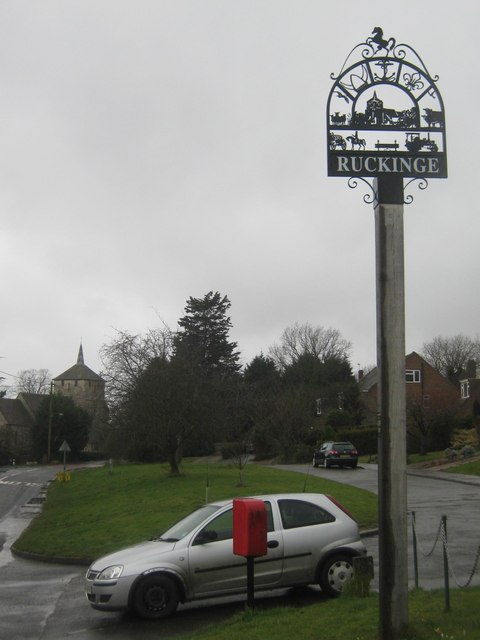
Image: © David Anstiss Taken: 21 Feb 2010
One of two village signs in the village on the B2067 Hamstreet Road. Behind is Ramsley Green and in the background is St. Mary Magdalene Church. On the post is a metal plaque which reads 'VILLAGE SIGN EXPLANATION PLATE.November 2007. CENTRE: St Mary Magdelene,1086.(sic) BOTTOM: Averling and Porter built the first steam roller. Thomas Averling lived at Court Lodge. Richard Porter farmed at Langdon. Ransley brothers, smugglers and petty thieves hung at Penenden Heath in 1800. Wooden headboard in Churchyard. CIRCLE: Saxon Shoreway footpath. Royal Military footpath and marshland, cattle on higher ground. Scout and Guide Centre. The blue Anchor Pub,1850. TOP: Kent Invicta.' Note: Spelling of St Mary Magdalene is spelt St Mary Magdelene on the plaque.
Images are licensed for reuse under creativecommons.org/licenses/by-sa/2.0
Image Location
Latitude
51.066516
Longitude
0.889936