Flooding at Stank House Farm (#1)
Introduction
The photograph on this page of Flooding at Stank House Farm (#1) by Philip Barker as part of the Geograph project.
The Geograph project started in 2005 with the aim of publishing, organising and preserving representative images for every square kilometre of Great Britain, Ireland and the Isle of Man.

There are currently over 7.5m images from over 14,400 individuals and you can help contribute to the project by visiting https://www.geograph.org.uk
Flooding at Stank House Farm (#1)
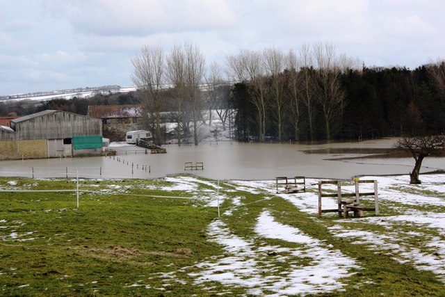
Image: © Philip Barker Taken: 23 Feb 2010
This photograph shows a view of some of the recent flooding that has taken place at Stank House Farm near Kilton. The picture was taken (looking in an easterly direction) from the field boundary/stile on the public footpath that runs between Kilton Lane and the farm. The footpath goes through the gate in the wall near the two caravans. A closer view of the flooded footpath can be seen here Image and here Image .
Images are licensed for reuse under creativecommons.org/licenses/by-sa/2.0
Image Location
Latitude
54.547505
Longitude
-0.922936