Main Street, Castlewellan, from the Market House
Introduction
The photograph on this page of Main Street, Castlewellan, from the Market House by Eric Jones as part of the Geograph project.
The Geograph project started in 2005 with the aim of publishing, organising and preserving representative images for every square kilometre of Great Britain, Ireland and the Isle of Man.

There are currently over 7.5m images from over 14,400 individuals and you can help contribute to the project by visiting https://www.geograph.org.uk
Main Street, Castlewellan, from the Market House
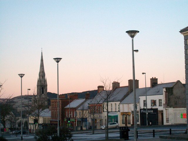
Image: © Eric Jones Taken: 20 Feb 2010
The spire is that of St Malachy's Catholic Church. Castlewellan is overwhelmingly a Catholic and Nationalist town - only 7 per of its population are from a non-Catholic background. Its neighbour, Rathfriland, a ten minute drive away, is not only a mainly Protestant town but one with a very strong Loyalist tradition.
Images are licensed for reuse under creativecommons.org/licenses/by-sa/2.0
Image Location
Latitude
54.257549
Longitude
-5.943454