Melanie House
Introduction
The photograph on this page of Melanie House by Andy Waddington as part of the Geograph project.
The Geograph project started in 2005 with the aim of publishing, organising and preserving representative images for every square kilometre of Great Britain, Ireland and the Isle of Man.

There are currently over 7.5m images from over 14,400 individuals and you can help contribute to the project by visiting https://www.geograph.org.uk
Melanie House
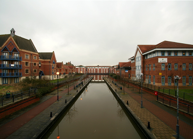
Image: © Andy Waddington Taken: 18 Feb 2010
Teesside Development Corporation's vision for the redevelopment of Stockton and its surroundings involved a mix of office buildings a residential areas around the River Tees, whose water quality was much improved by fixing its level at 2.65m above Ordnance Datum by means of the Image], thus avoiding twice-daily exposure of large areas of stinking mudbanks. It is hardly Venice, but some of the developments are quite striking and in this area the buildings styles seem to go together quite well. Some of the other nearby developments look more like something built by a six-year-old in a video game...
Images are licensed for reuse under creativecommons.org/licenses/by-sa/2.0
Image Location
Latitude
54.560987
Longitude
-1.303316