
Cowan Head mill rapid
Introduction
The photograph on this page of Cowan Head mill rapid by Andy Waddington as part of the Geograph project.
The Geograph project started in 2005 with the aim of publishing, organising and preserving representative images for every square kilometre of Great Britain, Ireland and the Isle of Man.

There are currently over 7.5m images from over 14,400 individuals and you can help contribute to the project by visiting https://www.geograph.org.uk
Cowan Head mill rapid
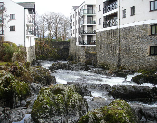
Image: © Andy Waddington Taken: 16 Feb 2010
Lying immediately below a difficult weir, and enclosed by walls, this steep grade 4 rapid is difficult to inspect, especially since fierce signs warn non-residents to keep out of the area which includes the bridge which would be a useful viewpoint. At least nowadays the rapids are in daylight whereas formerly "this once had the distinction of being underneath a factory and was only paddled in darkness by the very brave". The former mill has been converted into holiday flats, painted white and visible from miles away on the fells, bearing more than a passing resemblance to some of the more extreme post-war purpose-built French ski resorts, and looking very out-of-place in the otherwise green landscape dotted with stone-built farm buildings. The level in this photo is far too low to paddle, but a tide mark on the fields above the weir attests to the volume of water which passes here in flood.
Images are licensed for reuse under creativecommons.org/licenses/by-sa/2.0
Image Location

Latitude
54.369121
Longitude
-2.78264