Wet woodland at Par Pond
Introduction
The photograph on this page of Wet woodland at Par Pond by Kate Jewell as part of the Geograph project.
The Geograph project started in 2005 with the aim of publishing, organising and preserving representative images for every square kilometre of Great Britain, Ireland and the Isle of Man.

There are currently over 7.5m images from over 14,400 individuals and you can help contribute to the project by visiting https://www.geograph.org.uk
Wet woodland at Par Pond
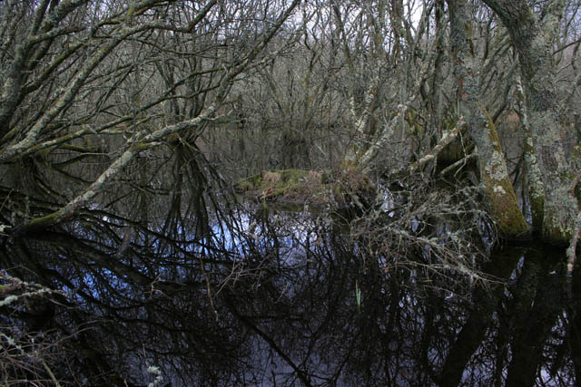
Image: © Kate Jewell Taken: 9 Feb 2010
Wet woodland occurs on poorly drained or seasonally wet soils. It is typical of river valleys, the surroundings of mires and raised bog, the transition zones between open water and drier ground, and, in this case, flooded river estuaries where the water table is high. Alder, birches and willows are the characteristic trees found in this type of habitat, as they are able to extract oxygen from the water saturated habitat. Wet woodland is a disappearing habitat due to land drainage for farming and there are only 50-70000 ha of this diverse habitat left in Britain. This area at Par Pond is important for the diverse wildlife supported including otters, numerous species of ducks, and grass snakes. The most common flowering plant in this area is the yellow flag iris which covers the low lying ground in a carpet of yellow between May and August. Note the emerging spike of leaves centre foreground in the photo.
Images are licensed for reuse under creativecommons.org/licenses/by-sa/2.0
Image Location


Leaflet Map data © OpenStreetMap
Latitude
50.357807
Longitude
-4.706222