
Bowston weir
Introduction
The photograph on this page of Bowston weir by Andy Waddington as part of the Geograph project.
The Geograph project started in 2005 with the aim of publishing, organising and preserving representative images for every square kilometre of Great Britain, Ireland and the Isle of Man.

There are currently over 7.5m images from over 14,400 individuals and you can help contribute to the project by visiting https://www.geograph.org.uk
Bowston weir
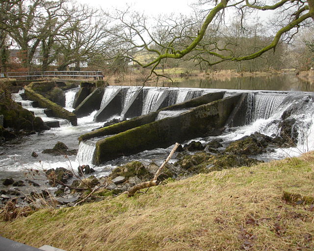
Image: © Andy Waddington Taken: 16 Feb 2010
A complex weir and a bit of a nightmare for canoeists, undoubtedly unrunnable at this low level. The guidebook suggests a possible route river left down the chute seen on the right of the photo. The landing looks rocky, but that is better than the concrete ledges of the main part of the weir, and may generate enough aerated water for a vaguely soft landing when the flow is sufficient. Fortunately, the river left bank (from where the photograph was taken) is a public footpath, so portage is straightforward.
Images are licensed for reuse under creativecommons.org/licenses/by-sa/2.0
Image Location

Latitude
54.363957
Longitude
-2.775001