Dismantled Railway
Introduction
The photograph on this page of Dismantled Railway by Philip Barker as part of the Geograph project.
The Geograph project started in 2005 with the aim of publishing, organising and preserving representative images for every square kilometre of Great Britain, Ireland and the Isle of Man.

There are currently over 7.5m images from over 14,400 individuals and you can help contribute to the project by visiting https://www.geograph.org.uk
Dismantled Railway
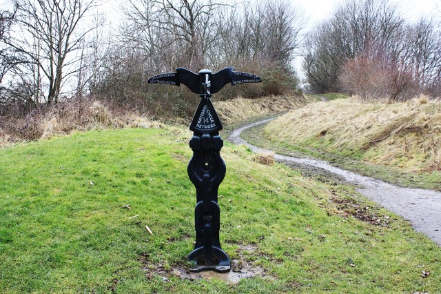
Image: © Philip Barker Taken: 19 Feb 2010
This photograph shows a view of the (now dismantled) railway that used to run between Stockton and Thorpe Thewles. The route now forms part of the National Cycle Network.The picture was taken looking in a north-westerly direction towards Thorpe Thewles.
Images are licensed for reuse under creativecommons.org/licenses/by-sa/2.0
Image Location
Latitude
54.559762
Longitude
-1.341223