Wollaton Road
Introduction
The photograph on this page of Wollaton Road by David Lally as part of the Geograph project.
The Geograph project started in 2005 with the aim of publishing, organising and preserving representative images for every square kilometre of Great Britain, Ireland and the Isle of Man.

There are currently over 7.5m images from over 14,400 individuals and you can help contribute to the project by visiting https://www.geograph.org.uk
Wollaton Road
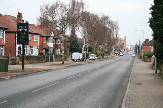
Image: © David Lally Taken: 18 Feb 2010
Looking south east toward Beeston town centre. The speed indicator on the left is the first device of its kind that I saw and has been here since at least October 2003. Here it is thanking an approaching vehicle for being within the 30 mile per hour speed limit. A red SLOW DOWN message is displayed if it detects a speed above the limit.
Images are licensed for reuse under creativecommons.org/licenses/by-sa/2.0
Image Location
Latitude
52.931268
Longitude
-1.220855