St Luke's Primary School, Elder Road
Introduction
The photograph on this page of St Luke's Primary School, Elder Road by Stephen Richards as part of the Geograph project.
The Geograph project started in 2005 with the aim of publishing, organising and preserving representative images for every square kilometre of Great Britain, Ireland and the Isle of Man.

There are currently over 7.5m images from over 14,400 individuals and you can help contribute to the project by visiting https://www.geograph.org.uk
St Luke's Primary School, Elder Road
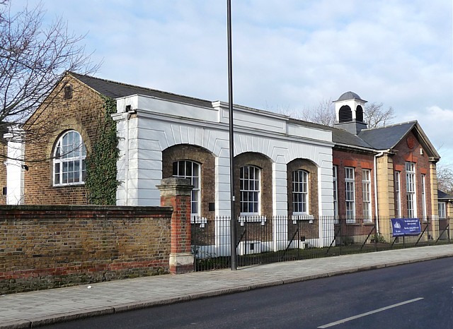
Image: © Stephen Richards Taken: Unknown
The left-hand section with channelled rustication dates from around 1850, while the right-hand section, with a charming little belltower, dates from 1908. Grade II listed. The building is within the Elderwood Road Conservation Area.
Images are licensed for reuse under creativecommons.org/licenses/by-sa/2.0
Image Location
Latitude
51.426738
Longitude
-0.10001