Barne Road, St Budeaux
Introduction
The photograph on this page of Barne Road, St Budeaux by Derek Harper as part of the Geograph project.
The Geograph project started in 2005 with the aim of publishing, organising and preserving representative images for every square kilometre of Great Britain, Ireland and the Isle of Man.

There are currently over 7.5m images from over 14,400 individuals and you can help contribute to the project by visiting https://www.geograph.org.uk
Barne Road, St Budeaux
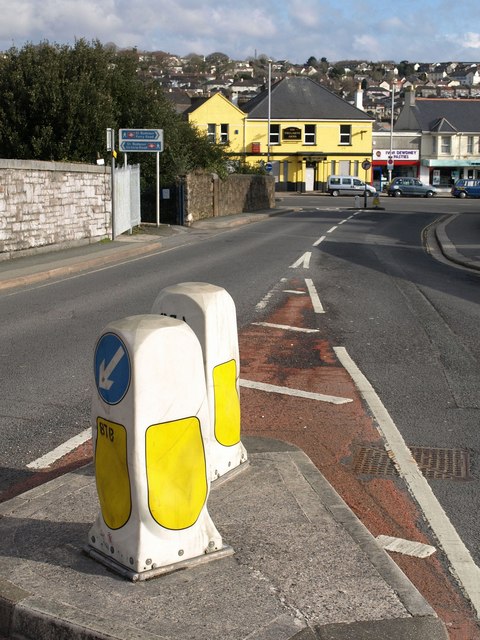
Image: © Derek Harper Taken: 9 Feb 2010
The road crosses two railway lines in quick succession to leave the Barne Barton estate and reach the shops on Wolseley Road. As the blue notices indicate, this means that the bridge gives access to two different stations on different lines, which must be unusual. On the left is a path to St Budeaux Victoria Road (see Image), on the Tamar Valley Line to Gunnislake, while off to the near right is St Budeaux Ferry Road station (see Image), on the Cornish Main Line. Perhaps that's why there are two road bollards so close together.
Images are licensed for reuse under creativecommons.org/licenses/by-sa/2.0
Image Location
Latitude
50.401278
Longitude
-4.188003