Wall protection, Belfast (5)
Introduction
The photograph on this page of Wall protection, Belfast (5) by Albert Bridge as part of the Geograph project.
The Geograph project started in 2005 with the aim of publishing, organising and preserving representative images for every square kilometre of Great Britain, Ireland and the Isle of Man.

There are currently over 7.5m images from over 14,400 individuals and you can help contribute to the project by visiting https://www.geograph.org.uk
Wall protection, Belfast (5)
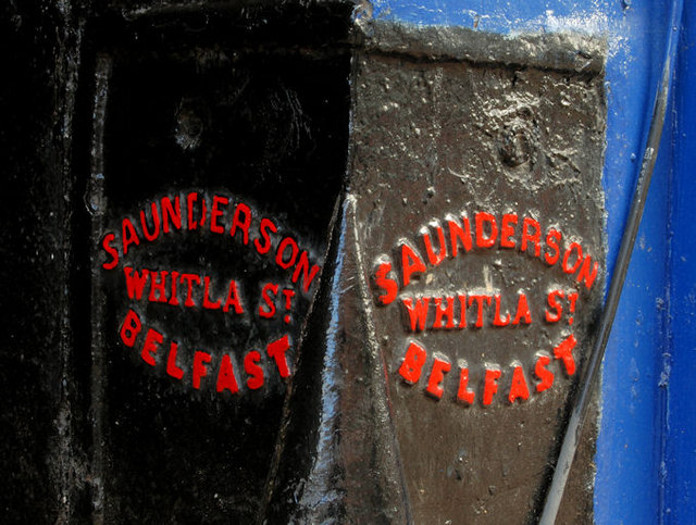
Image: © Albert Bridge Taken: 14 Feb 2010
See Image The inscription showing the name of the foundry. John Saunderson and Co traded from 61 Whitla Street during the last 20 (or so) years of the 19th century. What happened after that I don’t know but the premises seem to have been replaced by a fire station (not the present one though Image). Continue to Image
Images are licensed for reuse under creativecommons.org/licenses/by-sa/2.0
Image Location
Latitude
54.601689
Longitude
-5.927994