The North Calder Water
Introduction
The photograph on this page of The North Calder Water by Robert Murray as part of the Geograph project.
The Geograph project started in 2005 with the aim of publishing, organising and preserving representative images for every square kilometre of Great Britain, Ireland and the Isle of Man.

There are currently over 7.5m images from over 14,400 individuals and you can help contribute to the project by visiting https://www.geograph.org.uk
The North Calder Water
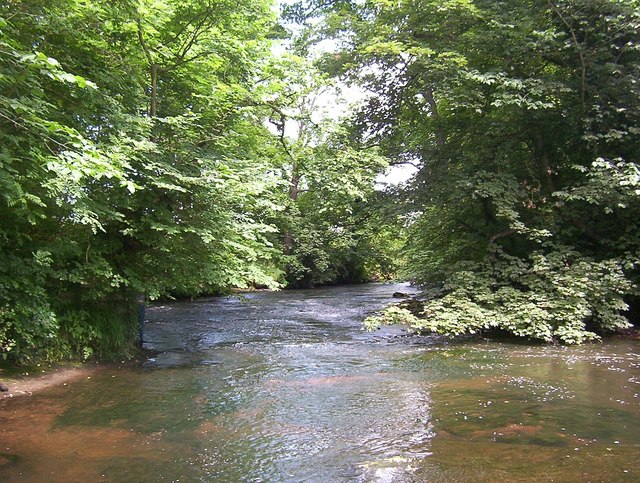
Image: © Robert Murray Taken: 2 Jul 2002
On the riverbed looking at where an ancient single arch span bridge crossed the river. The western abutment is still intact and can be seen to the left of the river. This bridge featured on Timothy Pont's manuscript of the area drawn in 1595 and was the main crossing on the road from Glasgow to Hamilton until the turnpike road further upriver (now the A74) was opened in the 19th. century.
Images are licensed for reuse under creativecommons.org/licenses/by-sa/2.0
Image Location
Latitude
55.832478
Longitude
-4.109852