Water Tower in Newnham valley
Introduction
The photograph on this page of Water Tower in Newnham valley by Penny Mayes as part of the Geograph project.
The Geograph project started in 2005 with the aim of publishing, organising and preserving representative images for every square kilometre of Great Britain, Ireland and the Isle of Man.

There are currently over 7.5m images from over 14,400 individuals and you can help contribute to the project by visiting https://www.geograph.org.uk
Water Tower in Newnham valley
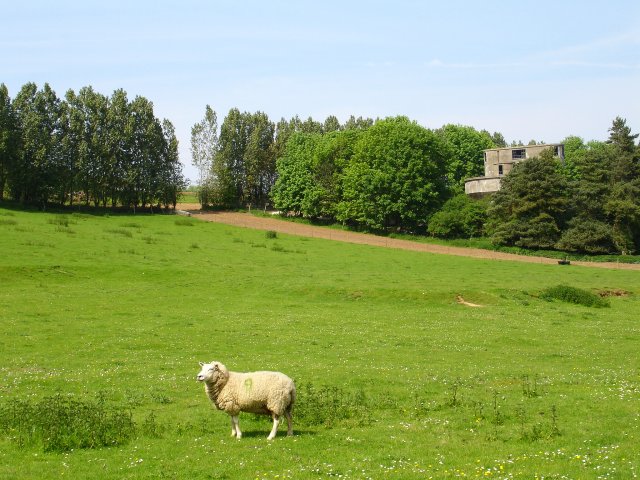
Image: © Penny Mayes Taken: 12 May 2006
Standing NW of Faversham Road, the style of this building makes it look like a misplaced cinema. I believe it was built in 1936 and is associated with a nearby water board pumping station and may have been an experimental water-softening plant. 2017: I now find this is a listed building https://historicengland.org.uk/listing/the-list/list-entry/1391820 and was indeed built in the 1930s for Mid Kent Water as a water softening plant of a type known as a sludge blanket clarifier. It consists of two conical tanks placed either side of an ellipse-shaped central tower. It was abandoned during the Second World War, only a decade after its construction, and although it reopened in 1946, it soon closed again, due in part to high operational costs. The building was sold in 2002, and discussions took place about its conversion to domestic use. In 2003 the 20th Century Society did a case study: https://c20society.org.uk/casework/former-water-softening-plant/ It has since been converted to a six bedroom house - see 2011 photo http://www.geograph.org.uk/photo/2989872 and many more estate agent photos, including interior shots from 2013 http://www.wowhaus.co.uk/2013/10/28/on-the-market-1930s-grade-ii-listed-the-lime-works-six-bedroom-house-in-norton-kent/ The building featured on Channel 4’s Gadget Man.
Images are licensed for reuse under creativecommons.org/licenses/by-sa/2.0
Image Location
Latitude
51.301464
Longitude
0.830498