Kelvinhead to Banton tramway
Introduction
The photograph on this page of Kelvinhead to Banton tramway by Robert Murray as part of the Geograph project.
The Geograph project started in 2005 with the aim of publishing, organising and preserving representative images for every square kilometre of Great Britain, Ireland and the Isle of Man.

There are currently over 7.5m images from over 14,400 individuals and you can help contribute to the project by visiting https://www.geograph.org.uk
Kelvinhead to Banton tramway
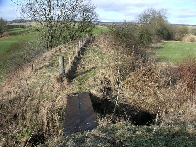
Image: © Robert Murray Taken: 13 Feb 2010
The remains of the bridge over the Craigdoffie Burn. The ironstone workings were situated approx 500 metres up the hill. The dimensions of the bridge remains left in situ are; Span between abutments = 3m. Length of remaining girders = 4.5m; The 2 girders are of a double sized type and 460mm wide. The width of the abutments on each side of the burns are approx. 2.3m. With the remaining iron structure only taking up less than 1 metre of the available 2.3m of the abutments it would be fair to assume that the original bridge was wider than the present remains. See related photos www.geograph.org.uk/photo/1706946 and www.geograph.org.uk/photo/1736244 RCAHMS report http://canmore.rcahms.gov.uk/en/site/45862/details/banton+to+kelvinhead+tramway/
Images are licensed for reuse under creativecommons.org/licenses/by-sa/2.0
Image Location
Latitude
55.99142
Longitude
-4.004505