Newhall House
Introduction
The photograph on this page of Newhall House by Anne Burgess as part of the Geograph project.
The Geograph project started in 2005 with the aim of publishing, organising and preserving representative images for every square kilometre of Great Britain, Ireland and the Isle of Man.

There are currently over 7.5m images from over 14,400 individuals and you can help contribute to the project by visiting https://www.geograph.org.uk
Newhall House
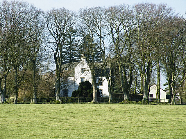
Image: © Anne Burgess Taken: 12 Feb 2010
This is a most attractive traditional house with two storeys and attic, and an unusual central gable. It is a Category B Listed building, and I was a bit surprised to see that it was built as late as the early 19th century.
Images are licensed for reuse under creativecommons.org/licenses/by-sa/2.0
Image Location
Latitude
57.038562
Longitude
-2.193105