Bridge to nowhere
Introduction
The photograph on this page of Bridge to nowhere by Paddy Griffin as part of the Geograph project.
The Geograph project started in 2005 with the aim of publishing, organising and preserving representative images for every square kilometre of Great Britain, Ireland and the Isle of Man.

There are currently over 7.5m images from over 14,400 individuals and you can help contribute to the project by visiting https://www.geograph.org.uk
Bridge to nowhere
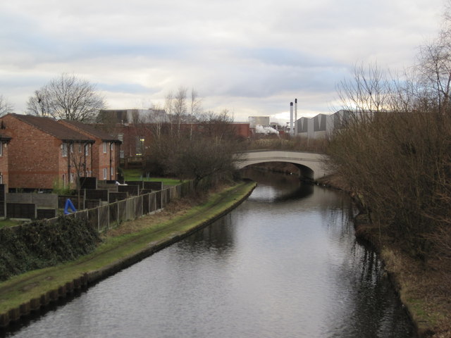
Image: © Paddy Griffin Taken: 12 Feb 2010
A view of the canal towards Kelloggs. The land to the right of the canal once was used by the Avro Company to build Lancaster bombers during WWII. Once the bridge carried Moss Road into Trafford Park, however the land now is used as warehousing for Kelloggs, which totally blocks the route. The only use for the bridge is a footpath carrying a public footpath.
Images are licensed for reuse under creativecommons.org/licenses/by-sa/2.0
Image Location
Latitude
53.456568
Longitude
-2.310644