Old air shaft, Currymire
Introduction
The photograph on this page of Old air shaft, Currymire by Robert Murray as part of the Geograph project.
The Geograph project started in 2005 with the aim of publishing, organising and preserving representative images for every square kilometre of Great Britain, Ireland and the Isle of Man.

There are currently over 7.5m images from over 14,400 individuals and you can help contribute to the project by visiting https://www.geograph.org.uk
Old air shaft, Currymire
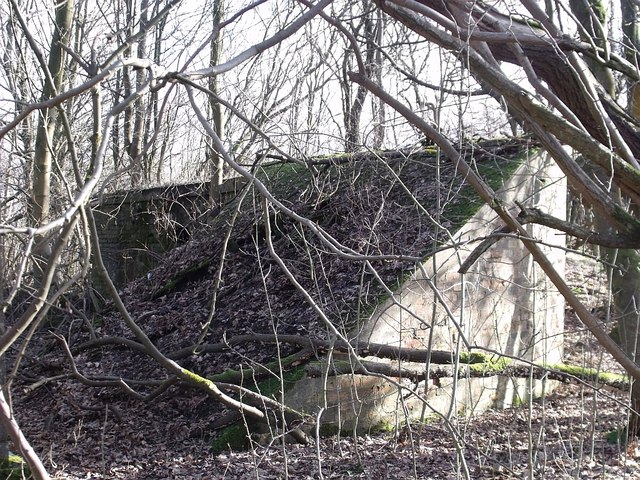
Image: © Robert Murray Taken: 10 Feb 2010
This curious looking building covers encloses what was sunk as a winding shaft for a 2km long haulage road which was driven from the Haugh pit at Kilsyth in 1923 to exploit a 1.25m thick seam of coal. However mining lasted only 12 years due to geological faults (Whin dykes) hemming in the seam on one side and flood water from the abandoned Riskend workings which finished extraction from this valuable seam.
Images are licensed for reuse under creativecommons.org/licenses/by-sa/2.0
Image Location
Latitude
55.979143
Longitude
-4.029836