Towers in Devonport
Introduction
The photograph on this page of Towers in Devonport by Derek Harper as part of the Geograph project.
The Geograph project started in 2005 with the aim of publishing, organising and preserving representative images for every square kilometre of Great Britain, Ireland and the Isle of Man.

There are currently over 7.5m images from over 14,400 individuals and you can help contribute to the project by visiting https://www.geograph.org.uk
Towers in Devonport
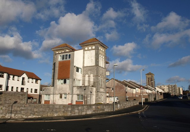
Image: © Derek Harper Taken: 30 Jan 2010
This is almost identical to Image, apart from the addition of flats on Wright Close on the left. The towers, including the one further along the road, at the entrance to Washbourne Close, were part of the former Royal Albert Hospital and Eye Infirmary http://www.plymouthdata.info/Hospitals-Royal%20Albert%20DEV.htm , which closed in 1981 when Derriford opened. The view is across New Passage Hill at its junction with Morice Square and Marlborough Street.
Images are licensed for reuse under creativecommons.org/licenses/by-sa/2.0
Image Location
Latitude
50.374458
Longitude
-4.179314