Coal Tax post no. 136
Introduction
The photograph on this page of Coal Tax post no. 136 by Stephen Craven as part of the Geograph project.
The Geograph project started in 2005 with the aim of publishing, organising and preserving representative images for every square kilometre of Great Britain, Ireland and the Isle of Man.

There are currently over 7.5m images from over 14,400 individuals and you can help contribute to the project by visiting https://www.geograph.org.uk
Coal Tax post no. 136
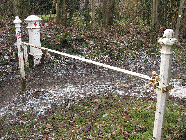
Image: © Stephen Craven Taken: 31 Jan 2010
The white post is a coal tax post http://en.wikipedia.org/wiki/Coal_tax_post at a point where several rights of way converge. Although it appears not to coincide with any present day civil administrative boundary, it does lie on the boundary between the Anglican dioceses of Southwark (in which Tadworth lies) and Guildford (which includes Walton-on-the-Hill).
Images are licensed for reuse under creativecommons.org/licenses/by-sa/2.0
Image Location
Latitude
51.288067
Longitude
-0.243846