Homestall Farm
Introduction
The photograph on this page of Homestall Farm by Penny Mayes as part of the Geograph project.
The Geograph project started in 2005 with the aim of publishing, organising and preserving representative images for every square kilometre of Great Britain, Ireland and the Isle of Man.

There are currently over 7.5m images from over 14,400 individuals and you can help contribute to the project by visiting https://www.geograph.org.uk
Homestall Farm
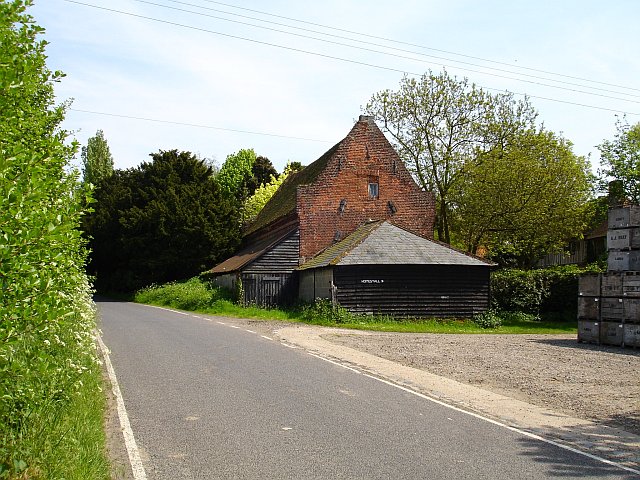
Image: © Penny Mayes Taken: 12 May 2006
The fine old farmhouse can just be seen to the right of the picture https://historicengland.org.uk/listing/the-list/list-entry/1069334 but this building is the stables https://historicengland.org.uk/listing/the-list/list-entry/1334366 . The entrance to the farmyard is guarded on the one side by this amazing old brick stables with its gable ends standing proud of the roof - an odd construction. The stacked wooden crates are bushel boxes for apples. Out of shot to the right is a square oast house http://www.geograph.org.uk/photo/170538 .
Images are licensed for reuse under creativecommons.org/licenses/by-sa/2.0
Image Location
Latitude
51.29862
Longitude
0.806651