North from Mount Wise Park
Introduction
The photograph on this page of North from Mount Wise Park by Derek Harper as part of the Geograph project.
The Geograph project started in 2005 with the aim of publishing, organising and preserving representative images for every square kilometre of Great Britain, Ireland and the Isle of Man.

There are currently over 7.5m images from over 14,400 individuals and you can help contribute to the project by visiting https://www.geograph.org.uk
North from Mount Wise Park
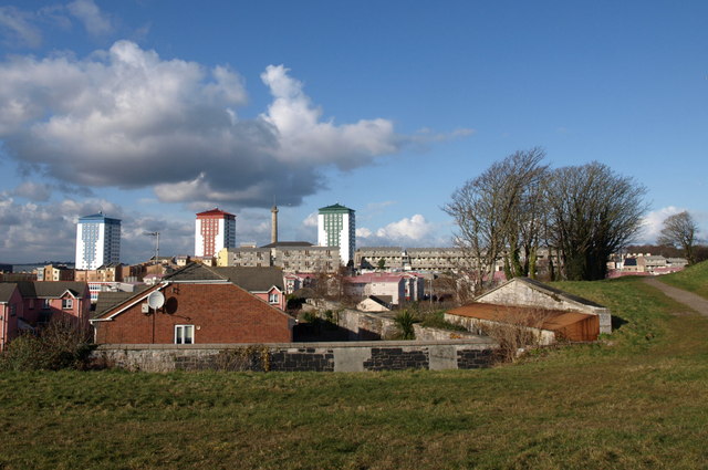
Image: © Derek Harper Taken: 30 Jan 2010
In the foreground are buildings on Garrison Close. The underground structure on the right at the edge of the park may be part of the Royal Laboratory, built in 1805 to manufacture ammunition for the Navy and later used as barracks - or could it be connected with Maritime Headquarters? (though I think that was further east). Beyond the grey housing around Ker Street rise three 47-metre 16-storey tower blocks dating from 1964 - Tavy House, Tamar House and Lynher House, each with about 90 flats.
Images are licensed for reuse under creativecommons.org/licenses/by-sa/2.0
Image Location
Latitude
50.366441
Longitude
-4.17515