Milestone, Sandford
Introduction
The photograph on this page of Milestone, Sandford by Maigheach-gheal as part of the Geograph project.
The Geograph project started in 2005 with the aim of publishing, organising and preserving representative images for every square kilometre of Great Britain, Ireland and the Isle of Man.

There are currently over 7.5m images from over 14,400 individuals and you can help contribute to the project by visiting https://www.geograph.org.uk
Milestone, Sandford
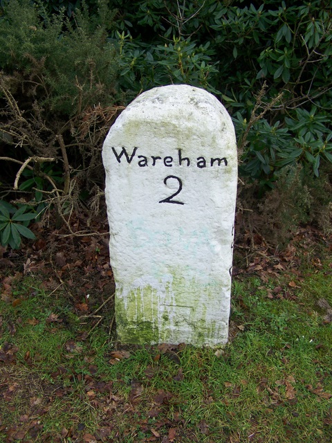
Image: © Maigheach-gheal Taken: 31 Jan 2010
Milestone beside the A351, near Sandford. The Legend reads Wareham 2. For a wider view see Image There is an OS cut mark benchmark at the bottom of the NW face. Old maps show this as BM 31.4ft (1890, 1902) and 30.5ft (1925) for Wareham 2, Poole 8. See http://www.bench-marks.org.uk/bm33399 for additional information.
Images are licensed for reuse under creativecommons.org/licenses/by-sa/2.0
Image Location
Latitude
50.711034
Longitude
-2.09484