Bethnal Green: Old Nichol Street
Introduction
The photograph on this page of Bethnal Green: Old Nichol Street by Dr Neil Clifton as part of the Geograph project.
The Geograph project started in 2005 with the aim of publishing, organising and preserving representative images for every square kilometre of Great Britain, Ireland and the Isle of Man.

There are currently over 7.5m images from over 14,400 individuals and you can help contribute to the project by visiting https://www.geograph.org.uk
Bethnal Green: Old Nichol Street
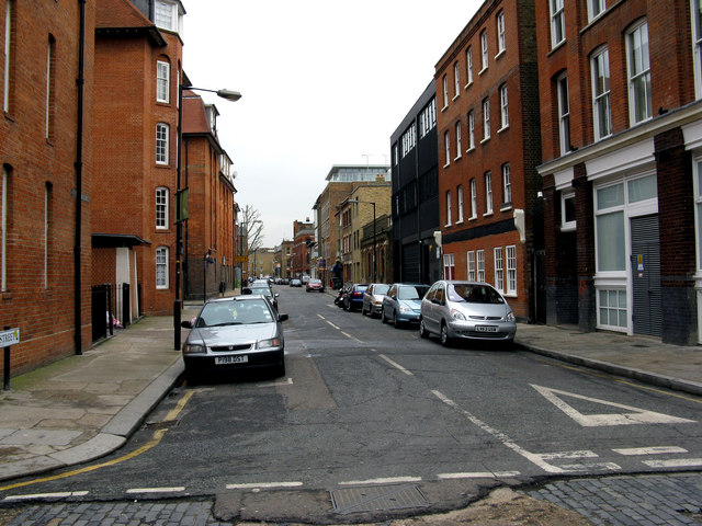
Image: © Dr Neil Clifton Taken: 3 Feb 2010
Looking east. The photographer stands in Boundary Street, with the Metropolitan Borough of Shoreditch behind him, and that of Bethnal Green in front. When the notorious Old Nichol rookery was cleared in the 1890s, the whole street pattern and names of the streets were changed, with only two or three streets on the edge retaining their names. Old Nichol Street and Boundary Street are two of these, although the former used to have the possessive, as Old Nichol's Street.
Images are licensed for reuse under creativecommons.org/licenses/by-sa/2.0
Image Location
Latitude
51.524904
Longitude
-0.075888