Shoreditch: Columbia Road
Introduction
The photograph on this page of Shoreditch: Columbia Road by Dr Neil Clifton as part of the Geograph project.
The Geograph project started in 2005 with the aim of publishing, organising and preserving representative images for every square kilometre of Great Britain, Ireland and the Isle of Man.

There are currently over 7.5m images from over 14,400 individuals and you can help contribute to the project by visiting https://www.geograph.org.uk
Shoreditch: Columbia Road
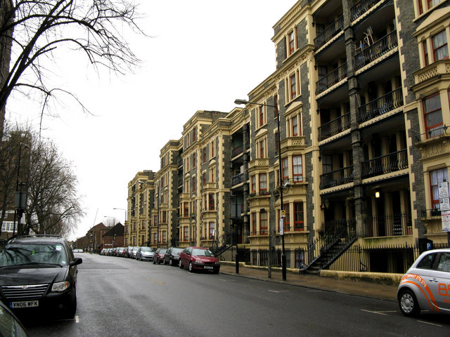
Image: © Dr Neil Clifton Taken: 2 Feb 2010
Columbia Road runs eastwards from Hackney Road, and is part of the B211. It has these magnificent six-story houses, which are now all subdivided.
Images are licensed for reuse under creativecommons.org/licenses/by-sa/2.0
Image Location
Latitude
51.528118
Longitude
-0.074455