Hobb's Lane
Introduction
The photograph on this page of Hobb's Lane by Evelyn Simak as part of the Geograph project.
The Geograph project started in 2005 with the aim of publishing, organising and preserving representative images for every square kilometre of Great Britain, Ireland and the Isle of Man.

There are currently over 7.5m images from over 14,400 individuals and you can help contribute to the project by visiting https://www.geograph.org.uk
Hobb's Lane
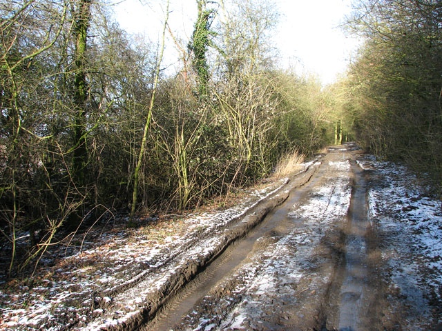
Image: © Evelyn Simak Taken: 1 Feb 2010
Marked on OS maps as 'other route with public access' this unsurfaced track links Harvey's and Swargate lanes in a straight line. The lane is bordered by a combination of high hedge and trees for most of its length, and ditches run along both sides of it. The deep ruts indicate that the local farmer has been along here with heavy machinery (the whole length of it). Thankfully the mud is frozen in the shaded areas. The track becomes virtually impassable where the sunshine reaches it for long enough to thaw the frozen ground.
Images are licensed for reuse under creativecommons.org/licenses/by-sa/2.0
Image Location
Latitude
52.51235
Longitude
1.397102