Coity Castle, Bridgend
Introduction
The photograph on this page of Coity Castle, Bridgend by Jaggery as part of the Geograph project.
The Geograph project started in 2005 with the aim of publishing, organising and preserving representative images for every square kilometre of Great Britain, Ireland and the Isle of Man.

There are currently over 7.5m images from over 14,400 individuals and you can help contribute to the project by visiting https://www.geograph.org.uk
Coity Castle, Bridgend
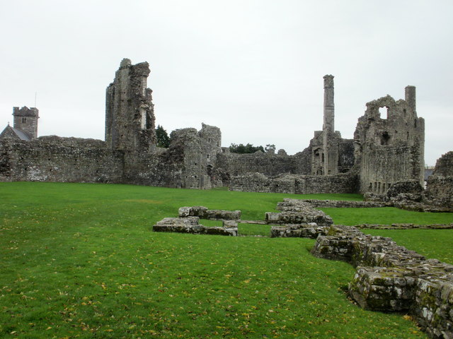
Image: © Jaggery Taken: 26 Oct 2009
Part of the ruins of Coity Castle. Although originally established soon after 1100, much of the castle dates from the 14th century and later. It was abandoned at about the beginning of the 17th century. Visible at the left edge of the photo is the Church of St Mary the Virgin. http://www.geograph.org.uk/photo/1689739
Images are licensed for reuse under creativecommons.org/licenses/by-sa/2.0
Image Location
Latitude
51.521216
Longitude
-3.553699