Pleasley Cross
Introduction
The photograph on this page of Pleasley Cross by Alan Murray-Rust as part of the Geograph project.
The Geograph project started in 2005 with the aim of publishing, organising and preserving representative images for every square kilometre of Great Britain, Ireland and the Isle of Man.

There are currently over 7.5m images from over 14,400 individuals and you can help contribute to the project by visiting https://www.geograph.org.uk
Pleasley Cross
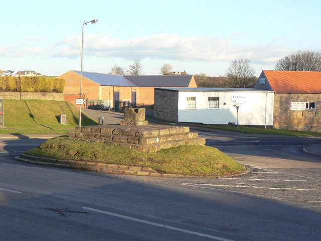
Image: © Alan Murray-Rust Taken: 31 Jan 2010
The remains of a 14th century cross at the junction of Chesterfield Road and Newboundmill Lane. This would originally have been the centre of Pleasley, but with the development of Pleasleyhill on the other side of the River Meden during the late 19th century, the centre of gravity of the community shifted. Listed grade II
Images are licensed for reuse under creativecommons.org/licenses/by-sa/2.0
Image Location
Latitude
53.172986
Longitude
-1.248052