Dulnain Bridge
Introduction
The photograph on this page of Dulnain Bridge by Les Shaw as part of the Geograph project.
The Geograph project started in 2005 with the aim of publishing, organising and preserving representative images for every square kilometre of Great Britain, Ireland and the Isle of Man.

There are currently over 7.5m images from over 14,400 individuals and you can help contribute to the project by visiting https://www.geograph.org.uk
Dulnain Bridge
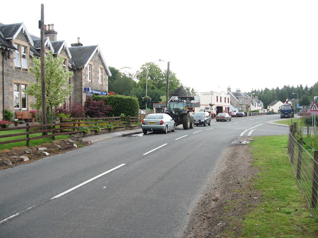
Image: © Les Shaw Taken: 28 Jul 2006
This looks along the main road east towards Grantown on Spey. The village shop and post office are on the left with the garage just along from that. The Roches Moutonnées rock formation is about half a mile further on the left. The road to the right crosses the bridge over the River Dulnain on the way to Skye of Curr and Aviemore.
Images are licensed for reuse under creativecommons.org/licenses/by-sa/2.0
Image Location
Latitude
57.303815
Longitude
-3.665703