Spring in the field
Introduction
The photograph on this page of Spring in the field by Robert Murray as part of the Geograph project.
The Geograph project started in 2005 with the aim of publishing, organising and preserving representative images for every square kilometre of Great Britain, Ireland and the Isle of Man.

There are currently over 7.5m images from over 14,400 individuals and you can help contribute to the project by visiting https://www.geograph.org.uk
Spring in the field
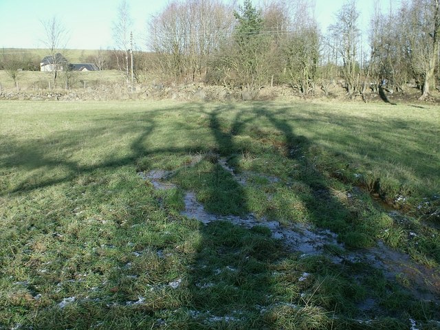
Image: © Robert Murray Taken: 30 Jan 2010
This is another part of the source of the River Kelvin jigsaw. Situated in a field behind the hamlet of Kelvinhead next to the road to Banton this mud spring bubbles from beneath and flows into the trees where the exposed burn flows in a gully. This spring escapes from a culvert under the field. This culvert was laid prior to 1899 over which the tramway ran from Kelvin Jetty on the Forth & Clyde Canal through this field for a short distance and via the left side of Banton Road - following the line of the burn - and then past [Low] Banton to the pits near Binniemyre. O.S. Second Edition of 1899 Stirlingshire Sheet XXIX. N.W. refers. The true source of the Kelvin is further up the Banton Road, south of Banton Kirk. See www.geograph.org.uk/photo/1686956 and www.geograph.org.uk/photo/1702700
Images are licensed for reuse under creativecommons.org/licenses/by-sa/2.0
Image Location
Latitude
55.984362
Longitude
-3.996445