Glenhead Feus Farm (remains)
Introduction
The photograph on this page of Glenhead Feus Farm (remains) by Texas Radio and The Big Beat as part of the Geograph project.
The Geograph project started in 2005 with the aim of publishing, organising and preserving representative images for every square kilometre of Great Britain, Ireland and the Isle of Man.

There are currently over 7.5m images from over 14,400 individuals and you can help contribute to the project by visiting https://www.geograph.org.uk
Glenhead Feus Farm (remains)
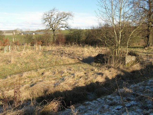
Image: © Texas Radio and The Big Beat Taken: 31 Jan 2010
Glenhead Feus was a farmstead belonging to Glenhead Farm www.geograph.org.uk/photo/1665186. Nothing really remains of the actual Glenhead Feus farm buildings, except for a few mounds of earth (where the young trees are to the left of picture) and some rubble. I'm reliably informed that the brick structure on the right was built to store the farm's rubbish. For some reason the actual farm was completely demolished but this structure remains (?).
Images are licensed for reuse under creativecommons.org/licenses/by-sa/2.0
Image Location
Latitude
55.962133
Longitude
-3.936502