Roundabout, Banbridge
Introduction
The photograph on this page of Roundabout, Banbridge by Albert Bridge as part of the Geograph project.
The Geograph project started in 2005 with the aim of publishing, organising and preserving representative images for every square kilometre of Great Britain, Ireland and the Isle of Man.

There are currently over 7.5m images from over 14,400 individuals and you can help contribute to the project by visiting https://www.geograph.org.uk
Roundabout, Banbridge
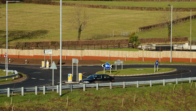
Image: © Albert Bridge Taken: 30 Jan 2010
The building of the new flyover Image (now fully open) involved the construction of this new roundabout on the Dromore Road Image The road at bottom left leads to and from the flyover. The one above it leads to the town centre and Lurgan/Portadown. The road to Dromore and Belfast is out of picture at middle right.
Images are licensed for reuse under creativecommons.org/licenses/by-sa/2.0
Image Location
Latitude
54.355531
Longitude
-6.241607