Footpath to Summerfield Road
Introduction
The photograph on this page of Footpath to Summerfield Road by P L Chadwick as part of the Geograph project.
The Geograph project started in 2005 with the aim of publishing, organising and preserving representative images for every square kilometre of Great Britain, Ireland and the Isle of Man.

There are currently over 7.5m images from over 14,400 individuals and you can help contribute to the project by visiting https://www.geograph.org.uk
Footpath to Summerfield Road
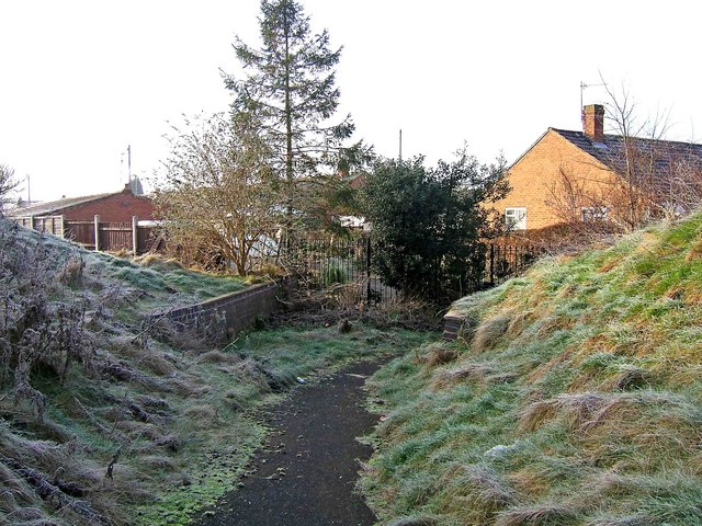
Image: © P L Chadwick Taken: 28 Dec 2009
The footpath is about to dive between the fenced back ends of people's gardens and some other fenced land. It's secluded, narrow and rather off-putting. The brick structures which can be seen either side of the path at this point, are undoubtedly connected with the former branch railway line to the demolished power station. It used to come through here, though at a much higher level. So these may have been the bases of pillars of a bridge or other structure. Image
Images are licensed for reuse under creativecommons.org/licenses/by-sa/2.0
Image Location
Latitude
52.343073
Longitude
-2.267399