
Bournemouth: Richmond Hill emerges into The Square
Introduction
The photograph on this page of Bournemouth: Richmond Hill emerges into The Square by Chris Downer as part of the Geograph project.
The Geograph project started in 2005 with the aim of publishing, organising and preserving representative images for every square kilometre of Great Britain, Ireland and the Isle of Man.

There are currently over 7.5m images from over 14,400 individuals and you can help contribute to the project by visiting https://www.geograph.org.uk
Bournemouth: Richmond Hill emerges into The Square
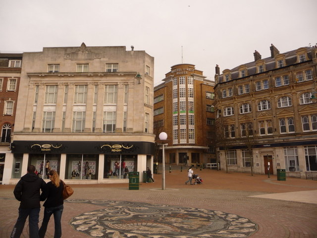
Image: © Chris Downer Taken: 27 Jan 2010
Standing in The Square, we look north at the emergence of Richmond Hill, which descends quite steeply to meet us. The Square was a roundabout prior to pedestrianisation in 1992, with the Hill a busy road for motorists. To the left, we see the Bournemouth branch of New Look, which used to be Burton menswear store until about 10 years ago. We are reminded of this by the foundation stone which was laid by one of the Burton family; only now as I upload this picture do I realise that the couple walking on our left are obscuring this detail – not to worry, a close-up will be found here: Image The rounded art-deco end of Bristol & West House is visible up Richmond Hill, beyond the NatWest bank – see Image and Image In the foreground we see the Image
Images are licensed for reuse under creativecommons.org/licenses/by-sa/2.0
Image Location

Latitude
50.720543
Longitude
-1.879396